


Les Écrins Cime de Pied Barry

c.gourme
User
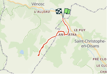

Length
14.8 km

Max alt
2718 m

Uphill gradient
1572 m
Km-Effort
36 km

Min alt
1170 m

Downhill gradient
1572 m
Boucle
Yes
Creation date :
2021-08-23 06:17:36.0
Updated on :
2021-09-01 19:42:22.035
8h06
Difficulty : Difficult

FREE GPS app for hiking
 SityTrail
IGN / Geographical institutes
SityTrail Plus
The world is yours!
About
Trail Walking of 14.8 km to be discovered at Auvergne-Rhône-Alpes, Isère, Les Deux Alpes. This trail is proposed by c.gourme.
Description
Endroit vertigineux. A faire par beau temps sans vent
Positioning
Country:
France
Region :
Auvergne-Rhône-Alpes
Department/Province :
Isère
Municipality :
Les Deux Alpes
Location:
Vénosc
Start:(Dec)
Start:(UTM)
274901 ; 4984545 (32T) N.
Comments